
You’ve got a plan to evacuate, but where exactly are you supposed to go? Most people wait until water’s rising to figure that out, and by then, shelters are full, hotels are booked, and half the roads are underwater. You need at least three safe destinations mapped out right now, in different directions from your home, before the next flood watch hits. This guide walks you through official shelters, high ground options, hotel strategies, family backup plans, and the life threatening mistakes that turn evacuations deadly.
Primary Safe Destinations and Critical Safety Information

Leave as soon as officials tell you to. Floodwater moves faster and rises higher than most people expect, and roads you drove yesterday can disappear under dangerous current in minutes.
You’ve got several safe destination options depending on what’s available, how much time you have, and where the water’s headed. The key is knowing your choices before you need them and having backup plans in different directions.
- Official emergency shelters and Red Cross facilities designated by local emergency management
- High ground areas and elevated locations at least 15 feet away from rising water
- Hotels and motels outside evacuation zones in non-flooded communities
- Pre-arranged stays with family or friends in safe areas not under evacuation orders
- Community centers and public buildings designated as temporary shelters
- Upper floors of sturdy multi-story buildings as last resort if escape becomes impossible
Official Emergency Shelters and Evacuation Centers
Emergency shelters operated by the Red Cross and local emergency management agencies are your primary option during flood evacuations. These facilities provide cots, water, basic food, restrooms, and climate control in safe locations outside flood zones. Staff members coordinate basic medical care, communication services, and information updates.
Most public shelters only allow service animals, not pets. You can’t bring weapons, alcoholic beverages, or illegal items into these facilities. Shelters fill quickly once mandatory orders go out, so arriving early improves your chances of getting space, especially if you need accessible accommodations or have medical requirements.
High Ground and Elevated Areas
When official shelters are too far or roads become impassable, move to the highest ground you can reach safely. Multi-story parking structures, hills, second or third floors of sturdy commercial buildings, and elevated highway overpasses can provide temporary refuge above rising water.
The goal is simple. Move as high and as far inland as possible from the water source. Even a few extra feet of elevation can put you above dangerous current and debris. High ground buys time until rescue services can reach you or water recedes enough to continue evacuating.
Hotels and Motels Outside Flood Zones
Book a hotel or motel well outside the evacuation area and flood zone boundaries as soon as watches or warnings are issued. Rooms fill fast once evacuation orders hit, and waiting means you’ll compete with thousands of other evacuees for limited space.
Make absolutely certain your hotel is truly outside the danger area. Check local flood maps, ask the hotel directly if they’re under any evacuation orders, and verify the property sits on high ground. Just because it’s 50 miles away doesn’t guarantee safety if it’s in a low lying river basin or coastal area under the same storm threat.
Family and Friends on Higher Ground
Pre-arranged stays with relatives or friends who live outside flood prone areas give you a destination with familiar faces and more comfort than public shelters. Confirm in advance that their location is truly safe. Not in an evacuation zone, not in a floodplain, and not under any warnings.
Have multiple family or friend contacts in different directions from your home. If your first choice lives south and flooding blocks southern routes, you need options to the north, west, or inland. Trade written plans so everyone knows where you might go and how to reach each destination.
Community Centers and Public Buildings
School gymnasiums, churches, civic centers, and recreation facilities convert to emergency shelters during major flood events. These buildings usually sit on higher ground and offer large indoor spaces that can accommodate many evacuees with basic necessities.
Don’t assume every community building will open as a shelter for every flood. Contact your local emergency management office before disaster threatens to find out which facilities activate during evacuations and under what conditions. Some only open for mandatory evacuations, not voluntary ones.
Upper Floors of Sturdy Buildings
When you can’t evacuate in time and water is rising around you, go to the highest floor of the strongest multi-story building you can access. Well constructed concrete or steel frame commercial buildings provide better protection than wood frame residential structures.
This is a last resort refuge, not a planned destination. Never shelter on upper floors of single story homes, mobile homes, or weak older structures that can collapse under flood pressure. Move to the roof only if rising water forces you there, and signal for rescue using bright cloth, flashlights, or whistles.
Plan at least three different destinations in different directions from your home and map out how to reach each one using official evacuation routes only. Six inches of moving water can knock a person over, and one foot of moving water can sweep a vehicle away, so drive only on non-flooded roadways following designated evacuation paths marked by emergency management.
Life-Threatening Hazards to Avoid During Evacuation

People die in floods because they drive into water they thought was shallow or attempt shortcuts through areas they assumed were safe. These mistakes happen in seconds and turn deadly before you realize the danger.
Water depth is impossible to judge accurately when it’s moving across pavement, especially at night or in heavy rain. What looks like a few inches can be a foot deep with current strong enough to push your car sideways off the road. What looks passable can hide a washed out road surface underneath.
- Any flooded roadways and streets regardless of apparent depth
- Underpasses, tunnels, and low lying road sections that collect water fast
- Low water crossings, bridges over swollen waterways, and flood prone intersections
- Creek banks, river edges, and areas near water bodies where ground can collapse
- Storm drains, culverts, and drainage channels with swift hidden current
- Below ground parking garages and basement areas that fill like swimming pools
- Coastal areas, beach roads, and shoreline routes exposed to storm surge
Six inches of moving water can knock a standing adult off their feet and send them downstream into debris or deeper current. One foot of water, just up to your shins, can sweep away most cars, SUVs, and trucks by lifting them off their tires and pushing them into deeper channels. Two feet of rushing water will float almost any vehicle, including large pickups and vans.
Official evacuation routes are designated because emergency managers have verified they stay above flood levels and avoid hazardous crossings. GPS apps and map programs don’t know which roads are flooding right now, and they’ll send you on the fastest route even if that route goes straight through three feet of moving water. Stick to the evacuation routes announced by local emergency management even if they look longer on a map. The extra 20 minutes of driving time keeps you alive.
Finding Official Emergency Shelters and Evacuation Centers

Find out where your nearest emergency shelters are located right now, not when you’re watching water creep up your driveway. Knowing shelter addresses, phone numbers, and which ones accommodate your specific needs eliminates decision paralysis when minutes matter.
Contact your county or city emergency management office through their website or non-emergency phone line before flood season starts. Their websites publish shelter lists, evacuation zone maps, and emergency hotlines you can call 24/7 during active events. Save these numbers in your phone under “Flood Shelters” or something you’ll remember during stress. Many counties operate emergency hotlines that activate during evacuations to answer questions about which shelters are open, which ones still have space, and which routes are passable.
The American Red Cross operates a shelter finder on their website and through their Emergency App for smartphones. During active disasters, call 1-800-RED-CROSS to speak with someone who can direct you to the nearest open facility with available capacity. Their information updates in real time as shelters open, fill up, or relocate, so calling 30 minutes before you leave gives you current status instead of outdated website listings.
Public shelters provide cots, water, basic food, and restroom facilities but not luxury or privacy. Most shelters only allow service animals, not pets, and all facilities prohibit weapons and alcoholic beverages. Expect shared sleeping spaces, limited electrical outlets, basic box meals, and restricted visiting hours.
Shelters have capacity limits and fill on a first come basis once mandatory evacuations are ordered. Arriving within the first few hours of opening improves your chances of securing space and choosing your sleeping area. Some facilities offer pre-registration programs where you submit contact information and basic needs ahead of time, which speeds check in and helps staff plan for medical equipment, accessible accommodations, or dietary restrictions.
Specialized Evacuation Shelters for Vulnerable Populations
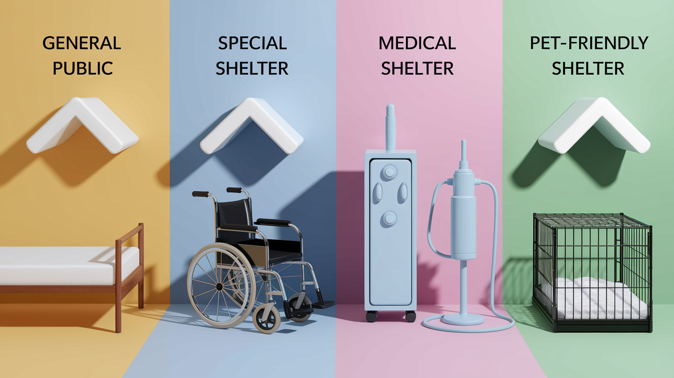
Standard public shelters work for most evacuees, but they’re not set up for people who need oxygen, wheelchair charging stations, refrigerated medications, nursing care, or a safe place to keep their pets.
Special needs shelters and medical shelters operate separately from general population facilities to accommodate wheelchairs, walkers, portable oxygen concentrators, CPAP machines, and other medical equipment. These shelters maintain climate control for medication storage, provide electrical outlets for battery charging, and staff nurses who can help with basic medical needs like medication administration, wound care, and monitoring of chronic conditions. Registration is usually required in advance, sometimes weeks before hurricane or flood season, so staff can prepare appropriate space and supplies.
Pet friendly evacuation options are extremely limited because most shelters can’t safely accommodate animals in shared sleeping spaces due to allergies, phobias, and sanitation concerns. Some communities designate separate pet friendly shelters or allow crated pets in specific sections, but these fill almost immediately. Your better option is arranging advance boarding at a veterinary clinic, pet hotel, or kennel located outside the evacuation zone, or coordinating with family or friends who can temporarily house your animals in safe areas.
| Shelter Type | Who It Serves | Key Features |
|---|---|---|
| Special Needs Shelter | People with mobility disabilities, medical equipment, chronic conditions requiring support | Accessible facilities, electrical outlets for equipment, nursing staff, climate control, wheelchair space |
| Medical Shelter | Evacuees with acute medical conditions, oxygen dependence, medication refrigeration needs | On-site nursing care, medication storage, emergency medical equipment, monitoring services |
| Pet-Friendly Shelter | Evacuees with pets (extremely limited availability) | Designated pet areas, crating requirements, proof of vaccinations, separate from main sleeping areas |
| General Public Shelter | All evacuees in good health without specialized medical or accessibility needs | Cots, water, basic meals, restrooms, climate control, service animals only |
Pre-register with your local emergency management office by providing documentation of medical conditions, prescriptions, required equipment, and mobility limitations. Bring 3 to 5 days supply of all prescription medications, over the counter medicines, medical supplies, wheelchair batteries, oxygen, catheters, wound care items, and food for service animals when you evacuate.
Understanding Evacuation Zones, Routes, and Official Orders

Communities divide flood prone areas into evacuation zones, usually labeled with letters like A, B, C or numbers like Zone 1, Zone 2, based on elevation, distance from water, and flooding risk during different storm strengths.
You can find your home’s specific evacuation zone by checking your local emergency management website, entering your address into their online evacuation zone finder, or calling their non-emergency office. Many communities mail zone information with property tax bills or include it on county flood maps available at libraries and government offices. Knowing your zone tells you when to evacuate because emergency managers issue orders by zone, not by street name. “Zone A residents must evacuate immediately” means you go if you’re in Zone A, not if you’re watching from Zone C.
Mandatory evacuation orders mean you are legally required to leave and emergency services may not be able to rescue you if you stay. Voluntary evacuation advisories mean officials recommend leaving but aren’t requiring it yet, which usually indicates conditions are expected to worsen.
Always follow the designated official evacuation routes published by emergency management and displayed on roadside signs, not GPS directions or shortcuts you think will be faster. GPS apps route you based on normal traffic patterns and don’t know which roads are flooding, blocked by downed trees, or closed by emergency services. Official evacuation routes are specifically chosen because they avoid low water crossings, stay on higher ground, and route traffic away from coastal surge zones.
Pre-plan at least two different exit routes from your neighborhood to major highways or evacuation corridors before any emergency strikes. Drive these routes during normal weather so you know where turns are, how long they take, and what landmarks to watch for when visibility is poor.
What to Bring When Evacuating to Any Shelter Location

Emergency shelters provide a roof, a cot, drinking water, and basic meals, but nothing else. You need to bring your own medications, clothing, personal care items, phone chargers, and anything else that makes you functional for three to five days.
- Important documents in waterproof container. Driver’s licenses, passports, birth certificates, insurance policies, medical records, property deeds, banking information
- Prescription medications with 5 to 7 day supply and medical equipment like inhalers, glucose monitors, blood pressure cuffs, CPAP machines
- Drinking water, one gallon per person per day minimum, and non-perishable food like protein bars, crackers, peanut butter, canned goods with pop top lids
- Flashlight with extra batteries and backup lighting like a headlamp or small lantern
- First aid kit with bandages, antibiotic ointment, pain relievers, antiseptic wipes, tweezers, scissors, medical tape
- Personal hygiene items. Toothbrush, toothpaste, soap, shampoo, deodorant, feminine hygiene products, toilet paper, hand sanitizer
- Change of clothing appropriate for current weather and sturdy closed toe shoes for walking through debris
- Phone chargers, power banks, and battery backup for devices to maintain communication
- Cash and credit cards. ATMs may be without power and card readers may be offline
- Pet supplies if destination allows. Food, water, bowls, leash, collar with ID tags, medications, vaccination records
- Lightweight bedding, sleeping bags, or blankets since shelter cots are bare and facilities can be cold
- Copies of insurance policies, prescriptions, and emergency contact lists with phone numbers and addresses
Start preparing and assembling supplies 3 to 5 days in advance of flood season or as soon as watches are issued, not when mandatory evacuations are announced. Keep pre-packed evacuation kits in waterproof bins or duffel bags in an easily accessible location near your main exit door so you can grab them and go in under five minutes. Rotate seasonal clothing every few months. Swap shorts and t-shirts for warmer layers before winter, and check expiration dates on medications, batteries, and food items quarterly so nothing is outdated when you actually need it.
Timing Your Evacuation: When to Leave for Safety

The difference between a smooth evacuation and a deadly one comes down to when you leave, not just where you go.
Flood watches mean conditions are favorable for flooding to develop in your area within the next 12 to 48 hours, giving you time to prepare supplies, fuel your vehicle, and confirm your evacuation destination. Flood warnings mean flooding is occurring right now or will occur imminently, and you need to act immediately if you’re in a threatened area. The jump from watch to warning can happen in under an hour during flash flood events, especially in areas near rivers, creeks, or storm drainage.
When officials issue mandatory evacuation orders for your zone, leave right then. Don’t wait to see if it gets worse, don’t delay to pack one more box, don’t stop to convince a stubborn neighbor.
Voluntary evacuation offers huge advantages if you take it. You get first pick of hotel rooms before they sell out, you drive in light traffic instead of bumper to bumper panic crowds, you travel in daylight with good visibility, and you have time to choose your destination instead of taking whatever shelter still has space. Early evacuees also avoid the terror of watching water rise around their stalled car on a jammed highway with nowhere to go.
Waiting too long eliminates your safe departure options entirely. Roads become impassable when just six inches of water flows over them. Low water crossings you drove through this morning can be under three feet of raging current by afternoon during flash floods. Traffic congestion after mandatory orders turns a 45 minute drive into a four hour crawl, and that’s assuming flooding hasn’t already cut off your planned route. Nighttime evacuations are exponentially more dangerous because you can’t see flooded sections, debris in the road, or washouts until you’re on top of them.
Evacuation Transportation and Getting Help Reaching Shelters

Not everyone owns a car, can drive, or has access to a working vehicle during emergencies when they need to reach evacuation shelters quickly.
Many counties and cities operate free evacuation buses from designated pick up locations during mandatory evacuations. These buses depart from schools, community centers, transit hubs, or announced assembly points and transport residents to official emergency shelters outside the evacuation zone. Routes and schedules get announced through emergency alerts, local news, and emergency management websites once mandatory orders are issued.
If you have neighbors, family members, or friends who are evacuating and have room in their vehicle, coordinate shared rides to the same destination or along the same route. Use only one vehicle per family when possible to reduce congestion on evacuation routes and conserve fuel for families that have no alternatives.
Pre-register with your local emergency management office or social services department if you have mobility limitations, medical conditions that prevent you from driving, or lack access to a personal vehicle. Many jurisdictions maintain transportation assistance registries for residents who need help evacuating and assign vehicles or paratransit services to pick up registered individuals from their homes when orders are issued.
Contact your local emergency management office or social services agency weeks before flood season or hurricane season starts to learn about available transportation resources, registration procedures, pick up locations, and any documentation you need to provide. Waiting until flooding starts means you won’t get on the list in time.
Contacting Emergency Services and Finding Shelter Information

During floods, bad information kills people just as fast as rising water, so use only verified official sources for evacuation guidance and shelter locations.
Access your county or city emergency management department through their official website or call their published non-emergency hotline to get current lists of open shelters, evacuation zone orders, route closures, and transportation resources. Save these contact numbers in your phone before emergencies strike. Search “(your county name) emergency management” online and bookmark the website and store the hotline number under a contact name you’ll remember during stress like “FLOOD INFO” or “COUNTY EMERGENCY.” Subscribe to emergency alert systems and reverse 911 notifications through your local government websites so you automatically receive text messages and phone calls when evacuation orders are issued for your specific zone.
NOAA Weather Radio broadcasts continuous weather updates, severe flood warnings, evacuation orders, and shelter information 24 hours a day even during widespread power outages. Battery powered or hand crank weather radios keep working when your phone dies and cell towers fail.
| Contact Method | When to Use | What Information Provided |
|---|---|---|
| Local Emergency Management Website/Hotline | For current shelter locations, zone-specific evacuation orders, route updates | Open shelter addresses, zone orders, road closures, transportation resources, real-time updates |
| 911 Emergency Services | Only for immediate life-threatening emergencies requiring rescue | Emergency rescue dispatch, medical emergencies, trapped individuals, life safety threats |
| NOAA Weather Radio | Continuous monitoring during storms and floods, works during power outages | Severe weather alerts, flash flood warnings, evacuation orders, ongoing weather conditions |
| Emergency Alert System (TV/Radio) | For broadcast alerts and official announcements from authorities | Mandatory evacuation orders, shelter openings, route information, official safety instructions |
| Red Cross Hotline (1-800-RED-CROSS) | For locating open Red Cross shelters and facility capacity status | Nearest available Red Cross shelter, current capacity, special needs accommodations, pet policies |
Keep your phone fully charged at all times during flood threats, maintain backup battery packs with full charge, and use car chargers while evacuating to keep communication capability alive. Monitor multiple information sources. TV, radio, official websites, emergency alerts. And look for consistent messaging across all channels to verify accuracy before acting on instructions.
Pre-Planning Your Flood Evacuation Destinations

Planning your evacuation destinations before crisis strikes eliminates panic driven bad decisions when you’re watching water rise toward your front door.
Identify at least three potential destination options located in different geographic directions from your home. One to the north, one inland, one to the south or west, so you have alternatives if one evacuation route becomes blocked by flooding, downed trees, or traffic accidents, or if your first choice shelter reaches capacity. Primary routes fail regularly during major floods, and counting on one destination or one road leaves you trapped when conditions change.
- Identify three potential shelter destinations in north, south, and inland directions from home using local emergency shelter lists, hotels in safe zones, and family contacts
- Map two different driving routes to each destination avoiding common traffic bottlenecks, low water crossings, and flood prone roads
- Exchange complete written plans with a family member living outside your region who can serve as a central contact point if your household separates
- Establish an out of state family contact to coordinate communication if local cell towers fail or your family evacuates to different locations
- Schedule annual plan review every spring before hurricane season or flood season to update phone numbers, verify addresses, test that contacts still live in safe locations, and drive routes to check for new construction or changed traffic patterns
Write down your complete evacuation plan including shelter addresses, phone numbers, driving routes, out of state contact information, and meeting locations where separated family members will reunite. Keep printed copies in your car, your go bag, your workplace, and with trusted family members who don’t live with you. Verbal plans fall apart under stress. You forget addresses, can’t remember which highway exit to take, and lose critical phone numbers exactly when you need them most.
Share written copies with all household members old enough to read and make sure everyone knows where the printed plans are stored. Give a copy to your out of state family contact who can coordinate communication if you and your spouse evacuate separately or if children are at school when orders are issued.
Practice driving your planned evacuation routes during calm weather on a weekend afternoon when traffic is light. Time how long each route takes, note landmarks and turn points, identify gas stations and rest stops along the way, and spot potential problem areas like low lying sections that might flood first. Familiarity with the route reduces wrong turns and hesitation during the actual evacuation when visibility is poor and stress is high.
Update your contact information, shelter addresses, hotel phone numbers, and route conditions every year before flood season starts. Friends move to new houses, emergency management changes designated shelter locations, road construction alters highway access, and hotels close or change ownership.
Final Words
Knowing where to go when evacuating from flood means making decisions now, not during a storm.
Pick three destinations in different directions. Write down two routes to each one. Share the plan with everyone in your house.
Keep emergency contacts saved in your phone. Pack your go bag before flood season starts. And when officials say leave, go early.
The safer choice is always the one that gets you out ahead of rising water. You’ve got this.
FAQ
Q: Where should you evacuate during a flood?
A: During a flood, you should evacuate to official emergency shelters operated by Red Cross or emergency management agencies as your first choice. Alternatives include hotels outside flood zones, pre-arranged stays with family on higher ground, or community centers designated as shelters.
Q: Where should you go if you have to evacuate?
A: If you have to evacuate, go to designated evacuation centers announced by local emergency management first. If those are full or inaccessible, head to hotels outside evacuation zones, family or friends in safe areas, or elevated areas on high ground.
Q: Where should you go during an emergency evacuation?
A: During an emergency evacuation, go to official evacuation shelters listed by local authorities, followed by hotels outside danger zones, family or friends in non-flood areas, or upper floors of sturdy multi-story buildings when other options are unavailable.
Q: What should you take with you if you evacuate?
A: When you evacuate, take important documents in waterproof containers, prescription medications for 5 to 7 days, water and non-perishable food, flashlight, first aid kit, phone chargers, cash, change of clothing, and personal hygiene items for 3 to 5 days.
Q: How do I find official emergency shelters during a flood?
A: You can find official emergency shelters by contacting local emergency management offices, checking their websites or hotlines, using Red Cross shelter finder tools and mobile apps, or calling their 24-hour hotlines for real-time updates on open facilities.
Q: What is the difference between mandatory and voluntary evacuation orders?
A: Mandatory evacuation orders legally require immediate departure from your home due to life-threatening conditions. Voluntary evacuation advisories recommend leaving early for safety but do not legally require departure, though waiting may become dangerous later.
Q: When should I evacuate during a flood warning?
A: You should evacuate immediately when officials issue mandatory evacuation orders or flood warnings indicating flooding is occurring or imminent. Leave during daylight hours when possible, as roads become impassable within minutes during flash floods.
Q: Can I bring my pet to an evacuation shelter?
A: Most public evacuation shelters only allow service animals and prohibit pets. Pet-friendly shelters are extremely limited, so plan alternative boarding facilities or pre-arrange stays with family or hotels that accept animals before emergencies occur.
Q: What are evacuation zones and how do I find mine?
A: Evacuation zones are designated areas based on flood risk and elevation assigned specific letter or number codes. You can find your home’s evacuation zone using local emergency management websites, flood zone maps, or property records.
Q: What hazards should I avoid when evacuating during a flood?
A: When evacuating, avoid any flooded roadways regardless of depth, underpasses, low-water crossings, bridges over swollen waterways, creek banks, storm drains, below-ground parking, and coastal roads. Six inches of moving water can knock you down.
Q: What if I do not have a car to evacuate?
A: If you do not have a car, contact local emergency management to pre-register for assisted transportation, use municipal evacuation buses from designated pick-up points, or coordinate ride-sharing with neighbors, family, or friends heading to safe areas.
Q: How do I plan evacuation destinations in advance?
A: Plan evacuation destinations in advance by identifying at least three potential shelters or safe locations in different directions from home, mapping two routes to each, sharing written plans with family, and establishing an out-of-state contact to coordinate communication.